
What is the subtropical ridge?
Warm air rises in the tropics near the equator and moves south. It cools and falls, creating a broad region of high pressure.
A band of high pressure systems form along the middle latitudes of the southern hemisphere. This is the subtropical ridge.
It's part of the global circulation of the atmosphere. High pressure systems, also called anti-cyclones, generally move east along the ridge. They bring stable and dry conditions.
Where is the subtropical ridge?
The subtropical ridge runs around the globe at about 22° S to 66° S.
It moves north and south, influencing weather over large parts of Australia.
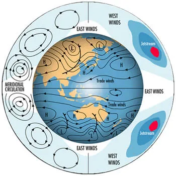
General circulation of the atmosphere. The subtropical ridge is the band of high pressure systems over Australia. Trade winds are north of this ridge.
How the subtropical ridge affects Australia
The subtropical ridge is present all year round. Its effect is greatest over central Australia, where the ridge is dominant for most of the year.
Dry air descends from the high pressure systems along the ridge, creating stable and drier conditions below. This is why central Australia is generally the driest part of the country.
November to April
From November to April, the subtropical ridge is generally south of Australia. The ridge blocks rain-bearing cold fronts. Any cold fronts that do get through generally tend to be weaker. Conditions in southern Australia are generally warmer and drier than winter, when the ridge is further north.
May to October
In autumn the subtropical ridge moves north, over the continent. It stays north for most of May to October.
While the ridge is north, it's easier for cold fronts to reach southern Australia. They bring colder south-westerly winds and showery conditions.

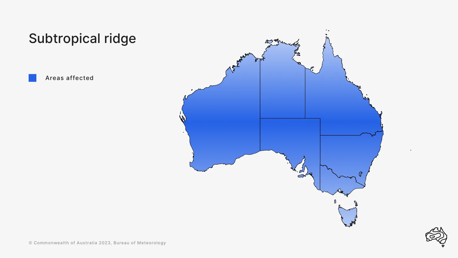
The subtropical ridge affects all of Australia but has greatest impact over central Australia. Its impact varies as it moves north and south over the continent.
Climate change and the subtropical ridge
The subtropical ridge travels north and south every year. It is getting more effective at chasing away cold fronts from parts of southern Australia. This means drier weather and later autumn breaks.
Its increasing strength is related to the rising global average temperature. For more about climate change, see the State of the Climate report.
Weather and climate factors related to the subtropical ridge
Monsoon
As the subtropical ridge moves south, the monsoon trough moves over northern Australia. The monsoon trough brings cloud and rain to tropical parts of the continent.
Southward movement of the subtropical ridge helps the monsoon trough develop.
Trade winds
When southern Australia enters autumn/winter:
- the monsoon trough shifts into the northern hemisphere
- trade winds begin to dominate weather in northern Australia.
Conditions become more settled in northern Australia. Generally, it's fine and sunny.