Features of severe thunderstorms in the tropics
Northern Australia has its own distinctive tropical climate, quite different from farther south. It experiences violent thunderstorms that can have different characteristics to those that typically happen in southern and central Australia. These tropical severe thunderstorms are also different to tropical cyclones.
The main severe weather types produced by thunderstorms in the tropics are damaging wind gusts and heavy rainfall. They may also bring:
- waterspouts, which can be a danger to boaters and cause damage near the coast
- tropical tornadoes, though these are rare.
Wind gusts
The wind gusts are 'straight line gusts'. These are due to the outflow from the downdraft of a thunderstorm as the air hits the ground and spreads out. The name given to an intense thunderstorm downdraft concentrated on a small area is a microburst.
Flash flooding
Flash flooding can occur with tropical thunderstorms when:
- they are slow-moving, so that the one location receives a prolonged downpour, or
- successive storms move over the same spot, like the carriages of a passing train. This is aptly called 'the train effect'.
Waterspouts
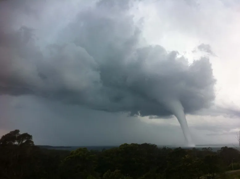
Waterspouts are occasional visitors to tropical (and extratropical) seas. They are mostly weaker non-supercell tornadoes and are not always associated with thunderstorms – often they develop at the base of smaller (cumulus) clouds which are rapidly growing.
Hail
Large hail is uncommon in the tropics. All thunderstorms contain hail high up in the cloud, but in the tropics it generally melts before hitting the ground.

Waterspout at Batemans Bay, New South Wales. Credit: Amy Lay, Bureau of Meteorology.
Types of tropical severe thunderstorms
There are 2 common types of thunderstorms in the tropics – pulse storms and squall lines. Both can lead to severe weather.
Pulse storms
A pulse storm is another name for a single thunderstorm with a brief lifecycle – typically under an hour.
Pulse storms tend to form where there is weak vertical wind shear – that is, the direction and strength of the wind does not change much with height above the ground. When the conditions are right for pulse storms, the clouds will develop in a more vertical fashion.
These storms have one or more strong updrafts, punching up through the atmosphere. These are followed by downdrafts. If intense enough, the downdrafts can bring strong wind gusts. The effects are usually brief and localised, limited to the area directly underneath the storm.
Pulse storms usually occur during the afternoon, when the hot ground can provide maximum energy for the updraft. If the atmosphere is very moist and the storm moves slowly, it can lead to flash flooding. It's also possible for dry layers of air over the lowest several kilometres of the atmosphere to make the downdraft stronger at the surface.
Squall lines
A squall line is a long line of thunderstorm cells, sometimes several hundred kilometres long. They share common precipitation cores or cloud mass.
Squall lines can last for hours or even days, with new storm cells continually forming along the leading edge of the line. They form when there is moist air near the ground and stronger vertical wind shear. The speed and direction of winds near the surface can be very different from the winds higher up.
As the clouds develop on days suitable for squall lines, they will tend to look 'tipped over' as their tops are 'pushed' by the winds higher in the atmosphere. A squall line can arrive at any time of day or night, depending where it initially formed and how quickly the line has been developing forward.
Top End squall lines often start over Arnhem Land, or further afield over Cape York and move west.
The approach of a squall line is heralded by a wind squall – the sudden onset of gusty winds lasting several minutes. This often coincides with a bank of dark, low cloud called a shelf cloud. Damaging wind gusts can happen over a much broader area compared to pulse storms, due to their greater size.