The weather influences the size, intensity and movement of bushfires – and how dangerous they can be.
We issue fire weather warnings to help keep Australians safe.
Understanding fire weather and how we warn you about it could save your life.
1. It's peak fire danger season somewhere, almost all year
Use this map to find out the most dangerous time where you live.

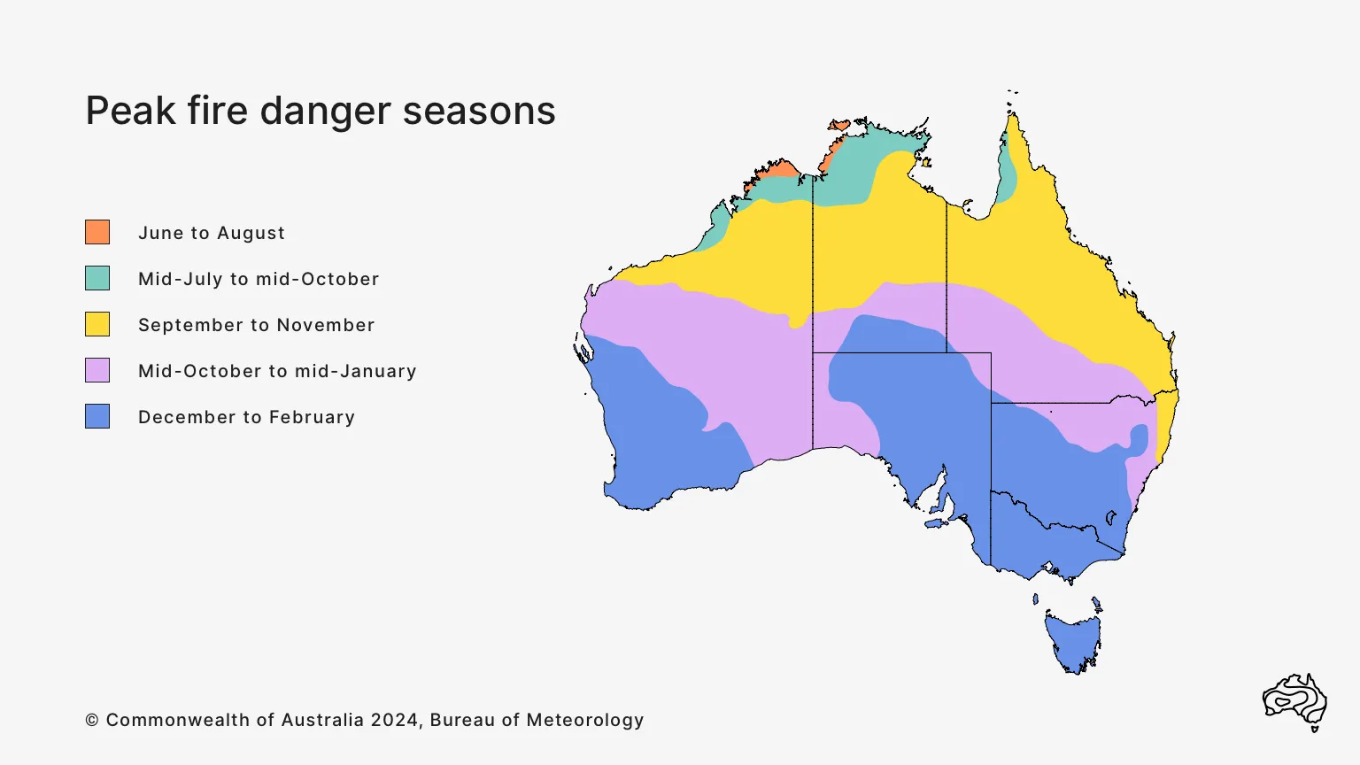
Fire danger seasons on this map are based on the Forest Fire Danger Index. Fire seasons can extend beyond the months shown. Source: Seamless climate change projections and seasonal predictions for bushfires in Australia – CSIRO Publishing.
2. Weather affects fire risk
It can encourage vegetation growth or dry it out to create an environment favourable for fires to begin and continue. It can start fires through lightning strikes and dramatically increase their size and danger through wind changes.
Rain can help put fires out. But it can also make it hard for firefighters to access burnt areas, cause erosion and affect water quality where rivers and other waterways carry ash.
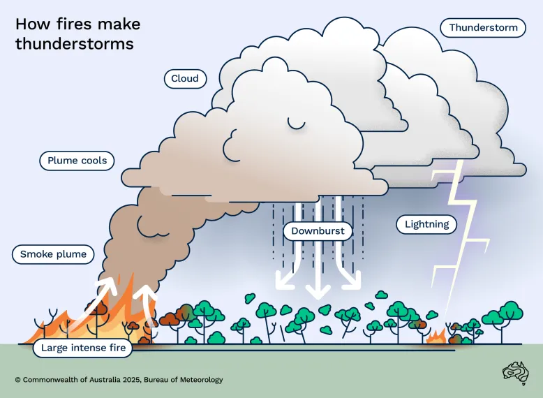
3. Fires can create storms
Known as pyrocumulonimbus, these storms can make the fire even more dangerous through strong updrafts. These can cause the fire to burn hotter and spread more quickly. They can also cause fires to change direction in unexpected ways.

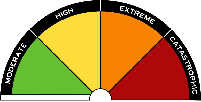
4. Ratings show how hard a fire will be to control
Fire danger ratings range from 'Moderate – plan and prepare' to 'Catastrophic – for your survival, leave bushfire risk areas'.
You can find the fire danger rating for your area – or one you're travelling to – by looking for your location in Forecasts and observations.
Australia's fire danger rating scale
5. Fire weather warnings tell you when it's likely to be dangerous
Warnings tell you when and where fire weather may affect your area.
You can see any active fire weather warnings on our Warnings and alerts page or through the BOM Weather app.